

Τιμή Εκδότη: 152,16 €
Διαθέσιμο κατόπιν παραγγελίας.
Χρόνος παράδοσης 2 - 6 εργάσιμες ημέρες, υπό την προϋπόθεση ύπαρξης αποθέματος στον εκδότη.
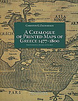
Thirty five years have elapsed since my catalogue of printed maps of Greece and Greek regions from 1477 to 1800 was firstly published in the tenth and eleventh volumes of the London quarterly Map Collectors` Series in 1974. This catalogue, which included 707 entries and ten photographs of maps, was succeeded by an edition of 2173 entries and a relatively rich corpus illustratum, published in 1982 (. . .). The catalogue was honoured with an award from the Academy of Athens in 1984 for `its outstanding contribution to the promotion of the History of Geography` (. . .). The outcome (. . .) is the present catalogue with its 3908 entries, its many corrections of errata and omissions of the previous editions and (. . .) its almost complete set of nearly 3000 photographs, covering a most extensive and representative part of the enlisted cartographic works (. . .).
[Απόσπασμα από κείμενο παρουσίασης εκδότη ή έκδοσης]
Σχετικά προϊόντα
-
Είναι ένα ποτάμι ζωντανό;
Τιμή Εκδότη: 19,90 €
Τιμή E-shop: 17,91 € -
Προσφορά!
Λύκος Ανάμεσα σε Λύκους
Τιμή Εκδότη: 24,00 €
Τιμή E-shop: 19,00 € -
Προσφορά!
Το σπίτι της ευθυμίας
Τιμή Εκδότη: 19,90 €
Τιμή E-shop: 13,90 € -
Τα ημερολόγια και τα σημειωματάρια της Patricia Highsmith
Τιμή Εκδότη: 24,50 €
Τιμή E-shop: 22,05 € -
Προσφορά!
Ακυβέρνητες πολιτείες: Αριάγνη
Τιμή Εκδότη: 17,25 €
Τιμή E-shop: 13,80 € -
Brotherakia - Coloring book Μικρή Ολλανδέζα
Τιμή Εκδότη: 12,20 €
Τιμή E-shop: 10,98 € -
Προσφορά!
Αποδοχή κληρονομιάς
Τιμή Εκδότη: 12,50 €
Τιμή E-shop: 8,80 € -
Babel
Τιμή Εκδότη: 18,80 €
Τιμή E-shop: 16,92 €